News
Serra do Amolar Gets a Long-Distance Trek in One of the Pantanal’s Most Remote Regions
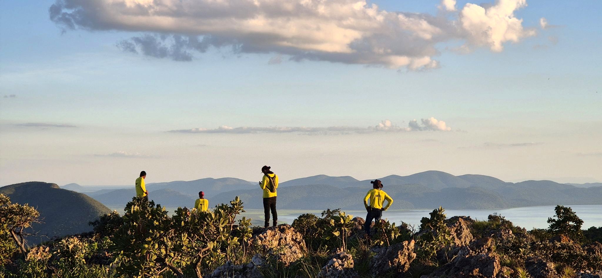
The new route combines hiking, boating, and kayaking in a seven-day expedition through a region where mountains, wetlands, and traditional communities coexist in one of Brazil’s most unique landscapes. The trek is funded by the GEF – Global Environment Facility.
When one thinks of the Pantanal, the most common image is that of a vast floodplain crisscrossed by rivers and teeming with wildlife. Few people imagine that, in the far west of Mato Grosso do Sul, near the border with Bolivia, a mountain range breaks through this landscape and creates one of the country’s most breathtaking settings.
That is where the Serra do Amolar is located—an 80-kilometer-long range formed by the final uplift events of the Andes Mountains (about 2.5 million years ago)—featuring rocky peaks up to 1,000 meters high, forests, floodplains, bays, traditional communities, and one of the highest concentrations of biodiversity in the Pantanal, which is home to the second-highest mammal population density on Earth, at 0.724 species per 1,000 km².
The area plays a vital role as a natural barrier to regulate the flow of springwater and ensure that flooding occurs in the Upper Paraguay River basin—a process of vital importance to the hydrological system and the regulation of wildlife for hundreds of species.
Despite its environmental and cultural significance—it is recognized as a UNESCO Biosphere Reserve—the region remains little known outside of scientific research, conservation, and local communities. Now, a new long-distance trail aims to bring visitors closer to this territory. This is the Guadakan Crossing, part of the Rede Trilhas network (https://www.redetrilhas.org.br/w3/), which offers a 360-degree view of the Pantanal and traverses the Serra do Amolar on a seven-day expedition that includes hiking, boating, and kayaking.
Along the route, participants can traverse trails in remote areas, navigate Pantanal rivers and bays, visit local communities, and explore landscapes rarely accessed by visitors to the biome. More than just an adventure itinerary, the goal is to reveal the different layers of a territory shaped by water, mountains, and human presence.
With the Guadakan Crossing, visitors have the opportunity to understand how one of the largest continental wetlands on the planet functions. The Pantanal plays a strategic role in regulating water on an international scale in South America, helping to maintain water flows that sustain economic activities, food chains, and ways of life across different territories. Changes to this system can have impacts that extend beyond its geographical boundaries.
During the trek, participants travel through areas where the dynamics of floods and droughts influence the landscape, wildlife, vegetation, and local ways of life. The route also provides insight into how different groups have built their relationship with the region over at least 5,000 years, including traditional communities and Indigenous peoples who remain connected to the history of the Serra do Amolar.
The route includes stops at iconic sites in the region, such as the Eng. Eliezer Batista and Acurizal-Penha Private Natural Heritage Reserves (RPPNs) and the Uberaba Guató Village, a community located on Ínsua Island. This region spans more than 50,000 hectares, is home to over 200 animal species, and provides habitat to protect at least 10 species of mammals and birds classified as vulnerable or endangered on the global list of threatened animals. The Guató Community, meanwhile, is known as the “canoe people,” with a way of life adapted to rivers and floodplains. Their journeys alternate between land and water in a territory where mountains and wetlands coexist in a way that is rare within the Pantanal.
“The Guadakan Crossing offers a very different perspective on the Serra do Amolar. Those who travel the route come to understand how the landscape changes along the way and how biodiversity, culture, and history are interconnected in this territory. It is an experience shaped by the place itself,” says Rodolfo Marçal, portfolio manager at FUNBIO.
The trek was organized as part of the initiatives carried out in the region by GEF Terrestre, a project focused on developing conservation, restoration, and management strategies for biodiversity in the Caatinga, the Pampa, and the Pantanal—Brazilian biomes that are underrepresented in the National System of Conservation Units. The project, carried out by the Instituto Homem Pantaneiro (IHP), is funded by FUNBIO, technically coordinated by the Ministry of the Environment and Climate Change, and carried out in partnership with other institutions involved in biodiversity conservation.
For the Instituto Homem Pantaneiro (IHP), the trail stems from a desire to showcase the Serra do Amolar beyond the images typically associated with the Pantanal. “We’re talking about a territory with ancestral ties to the Guató people, which connects regions and communities, plays an essential role in the reproduction of various animal species, contributes to the protection of biodiversity, and fosters a unique and singular connection with nature. It is part of one of the best-preserved areas of the Pantanal,” explains IHP President Ângelo Rabelo.
With approximately 24 kilometers of hiking and 20 kilometers of kayaking, the journey takes participants through a part of the Pantanal far removed from conventional itineraries. The route connects landscapes, stories, and forms of human settlement that help visitors understand the complexity of one of the country’s most unique regions.
The trail helps demonstrate the Pantanal’s resilience in facing growing challenges related to its water dynamics. Changes in rainfall patterns, prolonged periods of drought, increased frequency of fires, and human interventions along the rivers have affected the functioning of this natural system, which is directly dependent on the ebb and flow of the floodwaters. This balance is fundamental not only for the biome but also for maintaining the ecological processes that connect the Pantanal to other regions of the country and link the water supply to the Paraguay-Paraná Basin, the second-largest river system in South America.
At a time when fewer and fewer places remain off the beaten path, the Serra do Amolar remains a territory waiting to be discovered, and the Guadakan Crossing offers an opportunity to explore it at a leisurely pace, observing what usually goes unnoticed by those who merely pass through the region.